
Drawing Inventory & Map
C3DSorter01Inventory every drawing across a project and explore it as a map and a filterable table
Overview
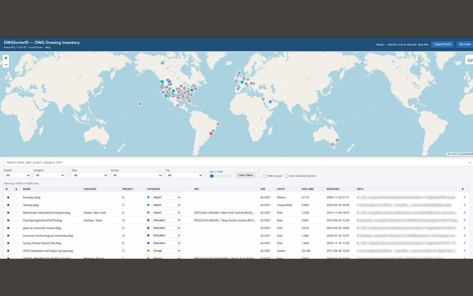
An interactive drawing inventory and sorting web app. A background scan walks local drives with live progress, converts each DWG to DXF, and reads Civil 3D's GEODATA object to resolve an EPSG code and reproject to WGS84, so every drawing becomes a pin on a map next to a filterable, sortable table. Supports category tagging, flagging corrupt files, and Excel export. It answers the question of which drawings exist and where they are, which on a large project is otherwise surprisingly hard to answer.
What it does
- Local drive scan with live progress
- GEODATA → EPSG → WGS84 geolocation
- Map view plus a filterable, sortable table
- Category tags and corrupt-file flagging
- Excel export
Built with
PythonFlaskezdxfODA File ConverterpyprojLeaflet.js